

Mam Vëlo duerch de Minett
Mam Vëlo op d’Schaff
De Minutte-Minett
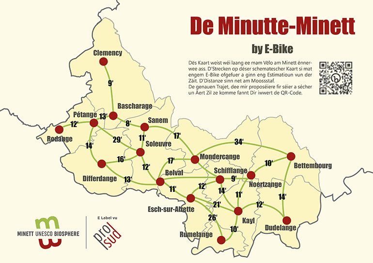
This map shows how long it takes to cycle a certain distance in the Minett. The routes on this schematic map have been ridden using an e-bike. The times are an estimate and the distances between places are not to scale.
Here you can find details of all the routes shown on the map of the Minett UNESCO Biosphere.
The route information comes from an external website specialising in cycling and walking routes. It is possible that current works and closures in the region are not indicated.
Dudelange – Bettembourg
Dudelange – Belval
via Schifflange
Dudelange – Esch/Alzette
via Kayl and Ellergronn
Bettembourg – Clemency
via Pontpierre – Ehlerange – Bascharage
Rumelange – Schifflange
via Tétange and Kayl
Belval – Pétange
via Oberkorn – Differdange – Niederkorn
Belval – Pontpierre
via Lallange and Mondercange
Rodange – Clemency
via Lamadelaine – Pétange – Bascharage
Esch/Alzette – Belval
via Vëlodukt
Belval – Sanem
via Soleuvre
Differdange – Sanem
via Niederkorn


